Project Description
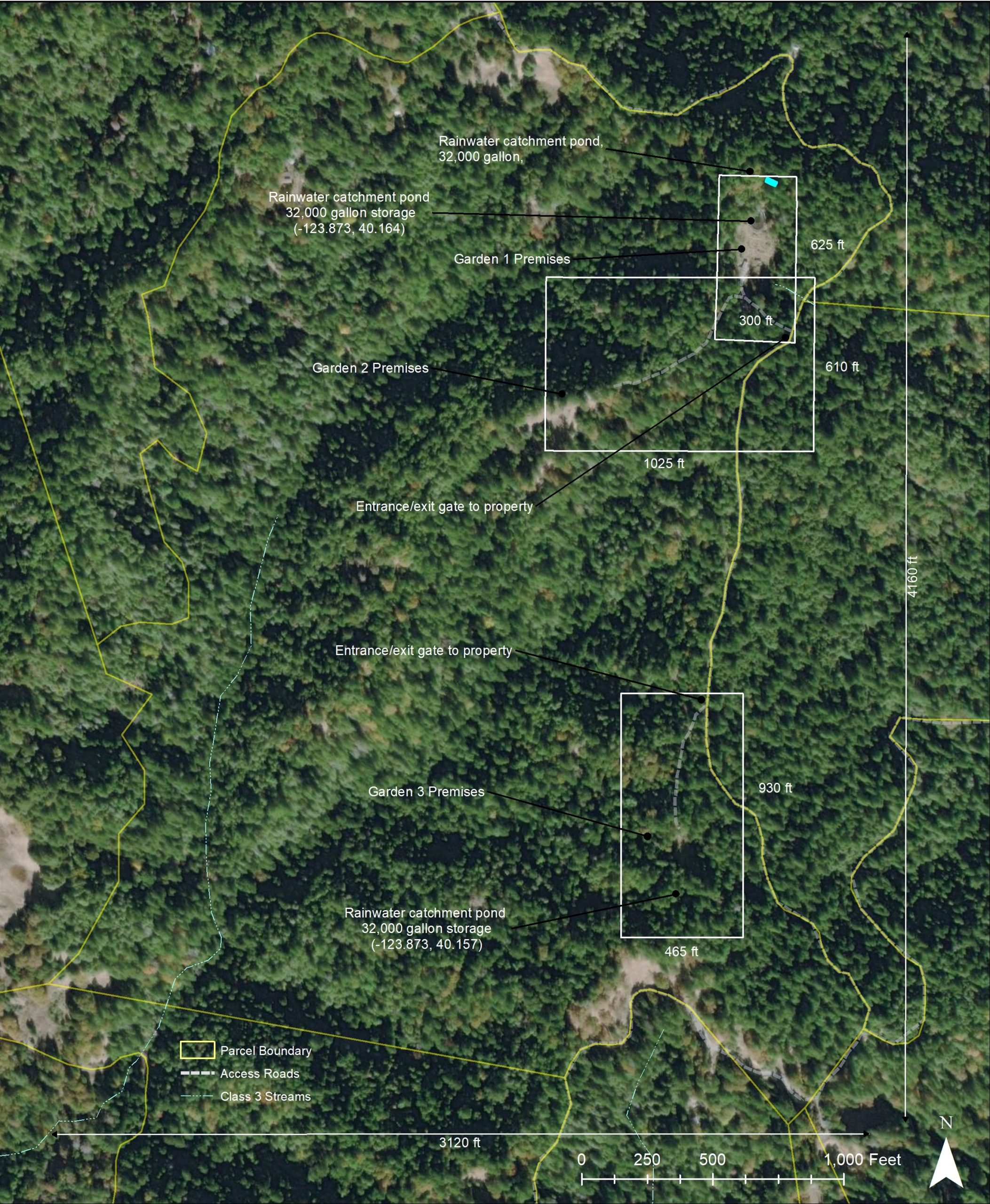
This map is known as the Property Diagram for the State of California Commercial Cannabis Permit application. It shows areas of commercial operation within the context of the parcel. These maps show general proximity of operations in relation to property boundaries, streams and access roads.
Streams proximity to access roads are important to monitor as dirt roads are a major source of sedimentation to waterways in this region. In the rainy season sediment washes from dirt roads into streams, and degrades sensitive Salmon nesting habitat.
These maps have been slightly redacted to protect client privacy.
